A Moutaineering adventure deep in Africa

Posted first on jorneriksson.no in 2013, edited in 2020. Author: Jørn Eriksson

Jørn Eriksson has written about his adventure, alongside his friend Andreas, climbing Mt. Stanley and Mt. Speke in the remote Bujuku valley on the border between Uganda and Congo.

There are days I will never forget. like the day we entered the amazing and remote Bujuku Valley after days of walking


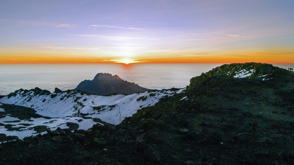
In year 200 a. c., long before any known European had set foot in deep Africa, the Greek Geographer Ptolemaios claimed that the Great Nile had it’s source from some big mountains he called “Mountains of the moon.” Many hundred years later it was confirmed that he was actually right, as the mountains do supply water to Victoria lake where the Nile runs from. Many life times after Ptolemaios we trekked for 8 days long through these epic mountans called the great “Mountains of the Moon” in Uganda.

They are perhaps the most scenic mountains and with out doubt the biggest range in Africa. From the deep jungle, we walked to the summit of the “Rainmaker” Mount Speke, Africa’s 4th highest mountain, over Arica’s largest glacier and to the summit of Uganda and Congo’s highest mountain, the Margerhita Peak at Mount Stanley that is Africa’s third highest mountain.

This is a hard trek that was much more challenging than my last trip to Africa, at Kilimanjaro. I am not talking about the fact that these mountains are more technical than Kilimanjaro where one can walk to the summit, but the that one have to struggle through thick jungle, bogs, mud, rain and in general very wet conditions. We had on gum boots more often than mountain boots.

Day 1Getting there

The previous year I did the mistake of booking a flight out Europe from Amsterdam. A little snow in Netherlands nearly set an stop to my entire trip to Africa. This time I went directly from Oslo to Doha, and from there to Entebbe. I really liked Qatar Airways, and they are flying to lots of interesting destinations all over the world. Our two flights went as scheduled, and we arrived in Entebbe on time. One thing I will never forget is when we fly over the African continent at night. In Europe there are many lights to see below everywhere, but in Africa there was nothing but darkness. Electricity is a luxury.


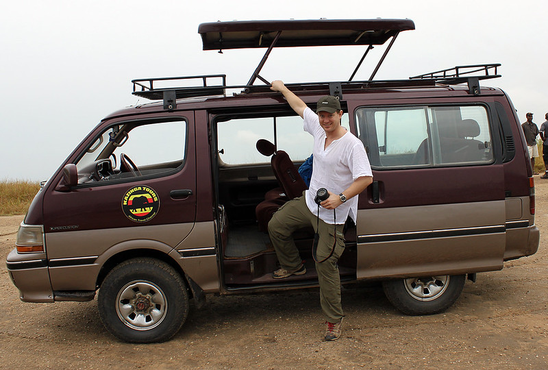
Day 2 – Driving to Queen Elisabeth National Park
 It was what the Africans call a cool morning in Entebbe as we met up with our private driver and safari guide on the airport. As a Norwegian I was suprised that it was so cold that I needed to zip up my fleeze jacket. After getting some local valuta in the airport we were soon settled in 4WD Hicace heading west to the Queen Elisabeth National Park, a nearly 2000 square mile big wilderness oasis at the foot of the Rwenzori mountains. However after just half an hour the driver decided to take a ferry someone tipped him about , claiming it would take us an hour to drive around the bay. Certainly as one could except in Africa, this was not a good idea in regard to time. The whole ferry operation took nearly two hours, but at least it was a great experience.

The ferry we crossed Victoria Lake with. It didn’t save us any time.

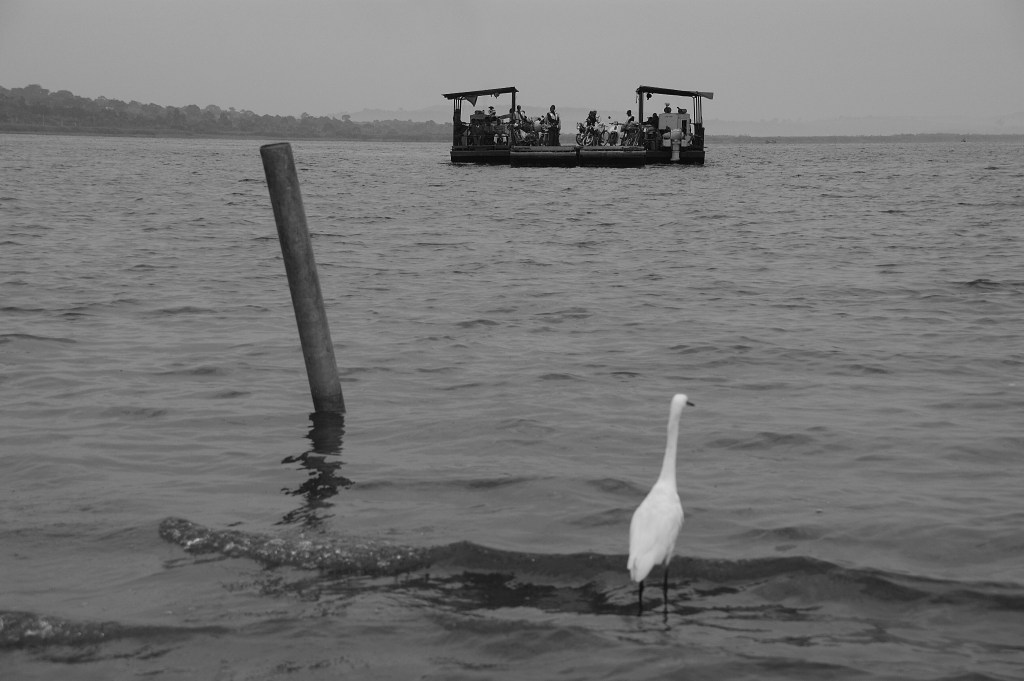
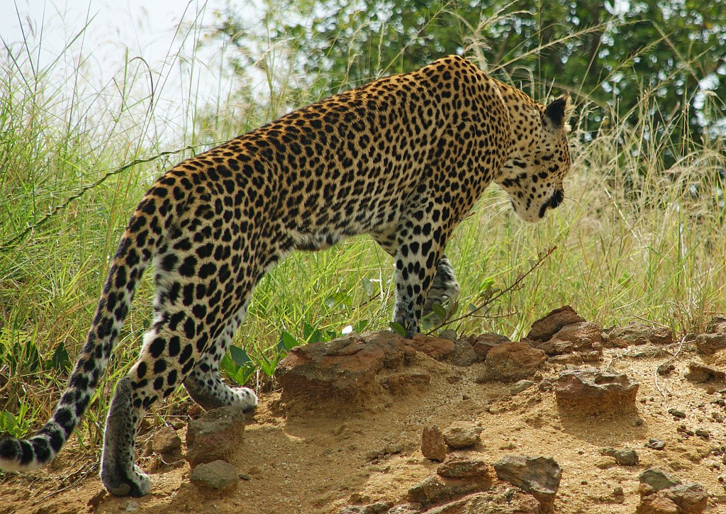
We mingled with locals that were curious about these to mzungus (mzungu is african nickname for white people. Some of the men on the ferry was very suprised over the fact that we were both in our mid-thirties and having no children. One of the men was 38, and he had already 10. Our driver jumped into the discussion saying that he had 25 sisters and brothers, but that things are chaning in Uganda. People have less children now than for just one or two generations ago. While discussing this we were all dressed up in life wests. The ferry was old and Africans are poor swimmers, so this was probably wise. After this interesting ferry-ride we were back in the car driving through some very interesting and green landscapes. Villages were lying as pearls on a string along the dirt road were were on. After an hour or so we came to what the driver called the highway. The only difference between the road came from and this was that this had asfalt. Our next stop was at the equator. This was actually a line in the road. We came from south and was now in the norhern hemisphere. We stopped for food and drinks twice on the road. We stopped several more times to take photos of things we spottet on our drive. A variety of animals, including zebras, stunnig scenaries, busy villages and towns were regular impressions. After 11 hours we reached the exotic Victoria Bush Lodge at the shore of Kazinga channel. Hippos were grassing outside our logde in the evening not making it entire safe to wander around. This was suppose to be our resting day, but instead it became a 12-hour long chase after lions. We started driving around the park already around six am. It was pretty cold with temperatures just above 10 celsius. We spottet many animals but no lions. After lunch we were lucky to spot a leopard only metres away, and on an afternoon boattrip on the river we got a safari-overload seeing hundreds of buffalos, elephants, crocs and so on. However our guide didn’t want to give up the lion hunt, so we went back to where they were likely to feed,and almost gave up when we late in the evening finally spottet a female leader in the grass .

Encounter at lunch.


Day 4 – Driving to Rwenzori, Starting Hike

In Nyakalenjigawhere we started our hike. I don’t remember my business in this particular place, but I have just started the long walk.

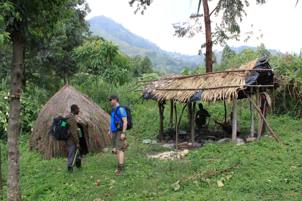
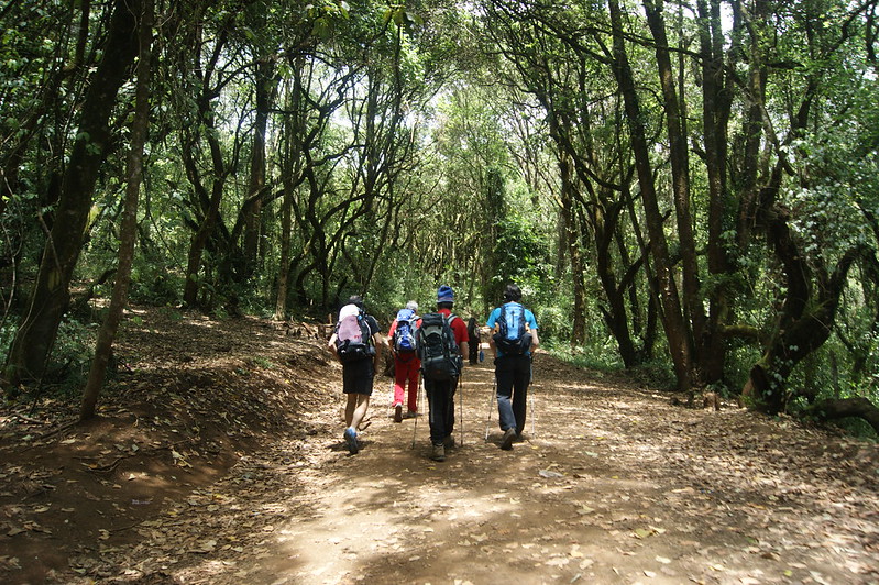
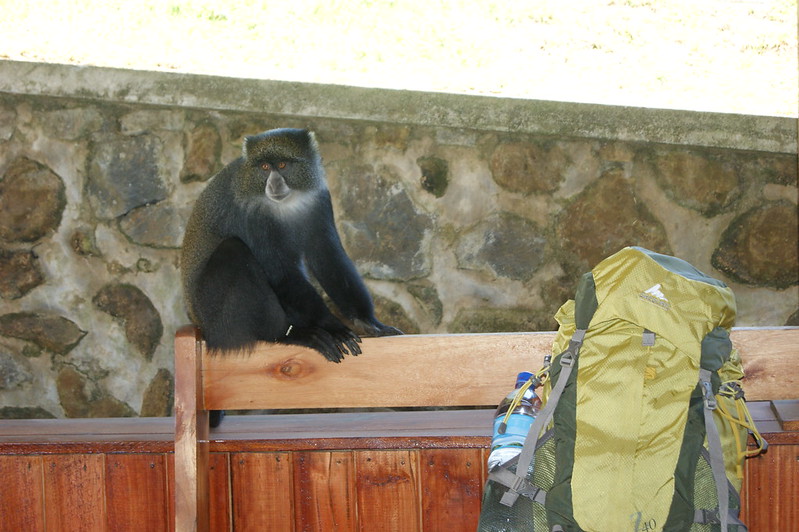
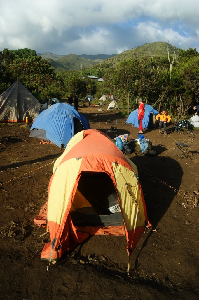
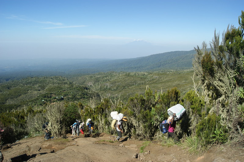
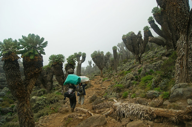
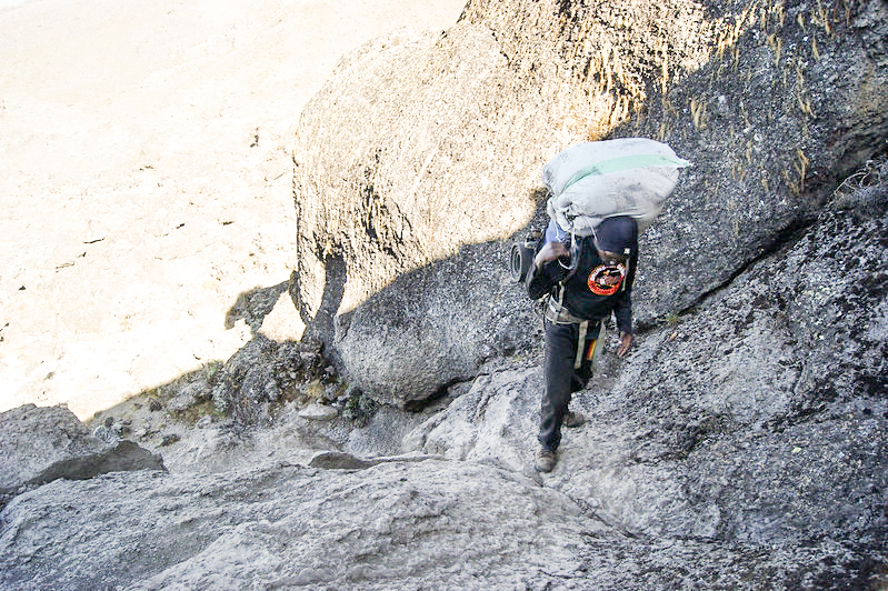
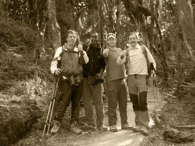
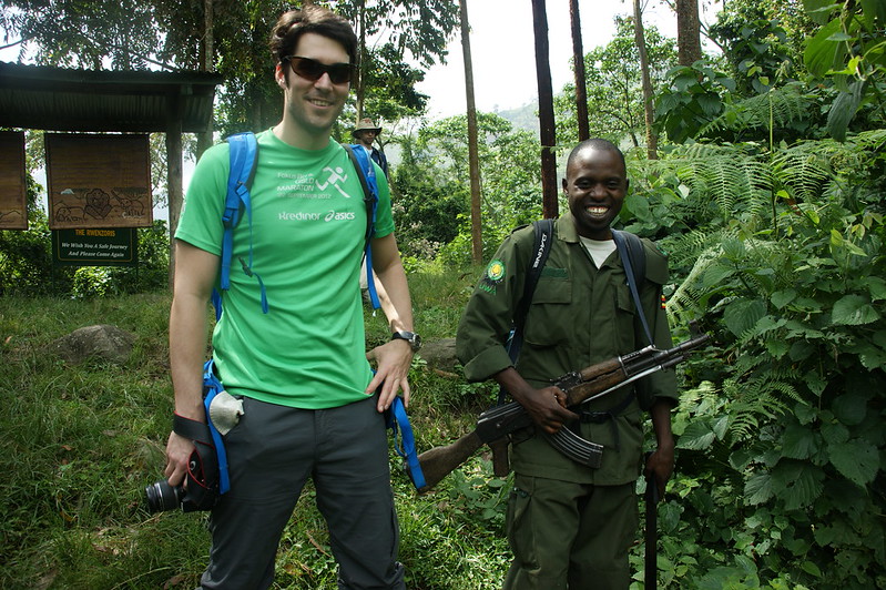
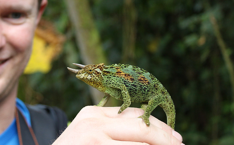
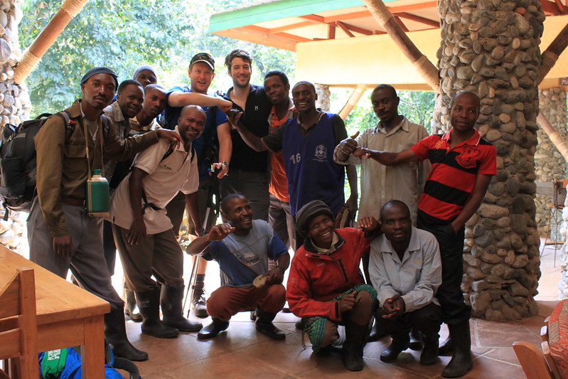
We were now excited to start our trek, and willingly jumped into the car around six that morning. On the way we spottet some hyenas in the road, making our safari experience complete. About two hours later we were inside the gates of Rwenzori Mountaineering Services in the village of Nyakalenjiga where our hike would start. After agreeing with the company on money-related issues,  having weighed our equipment and gotten the porters we needed we where ready to walk. It felt great to walk out the gate, and sign in to the park. (and yes, like on Kilimanjaro you need your passport number with you). We were now 14 porters, 1 cook, 2 guides, a student, and two clients that were us. All together we were 20 people heading for a 8 days long trek up the Rwenzori Mountains, only because two people from Norway, Andreas I wanted to climb two mountains.  The walk went along Mubuku river surrounded by rainforest much more impressive than what I witnessed in Kilimanjaro. The trees were gigantic. Along the way we played with chameleons, got bitten to blood by agressive red ants and heard the sounds of the Turacos in the trees. Often one can hear chimpanzees shouting from the forest on this stage. But we didn’t.

The best thing about Rwenzori is that you can drink water straight from the stream. Imagine that in Africa!

The sun was strong, and it was very hot. We didn’t get as much shadow from the trees that one could hope for in a rainforest. Thus, this was a hard leg. We walked 1000 altitude metres in four hours. Actually I advise you to spend longer time on this leg. The reason is that you will arrive the Nyabitaba hut long before your crew. There is not much to do at Nyabitaba except wait on a bench. This place is also suprisingly cold lying on ridge exposed for wind. Therefore save your energy, and enjoy the nature. It also turned out that the porters had forgotten our food. Some poor fellow then had to run all the way down to the village and back up again to get it. Can you imagine? There is clearly nothing heroic about people doing treks like this, when you experience the hard work of the porters here, and on other mountains.

The first few nights we had armed security with us, for protection.


Day 5 Hike to John Matte hut 

John Matte hut

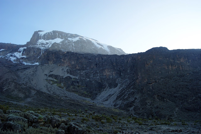
The following day we climbed 700 alitude metres using six hours in some hectic terrain with slippery roots, and bamboo-forest. At least the nature was beatiful, and in the forest we could hear the screams of monkeys warning their friends about the sweaty two Norwegians, and 18 helpers coming. Eventually we could see the snow covered Mount Stanley and it’s peaks. This felt good as it’s always nice to be able to see what one is aiming for.

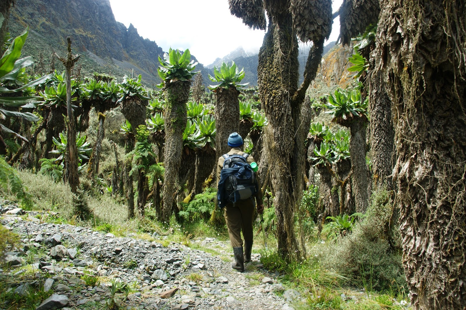
The vegetation zones where also changing this day, and we entered a forest of giant Lobelias, much greater in numbers than what I saw on Kilimanjaro. It’ was like being in a fairytale.
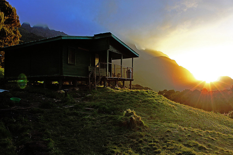
When we reached John Matte hut on 3380 masl. we didn’t feel very good. We both had headaches, and I wondered if it was because of the altitude (I never had problems with altitude sickness) or the fact that I was heavily burned by the sun in face and ears. As the evening fell on we felt much better, and I didn’t experience such problems again on this trip. However we decided to slow down the following day.  By the way, John Matte is a cosy hut in beatiful surroundings and with wonderful morning view of the sunrise behind the Portal peaks.

Day 6 Hike to Bujuku huts 

Lower Big Bog

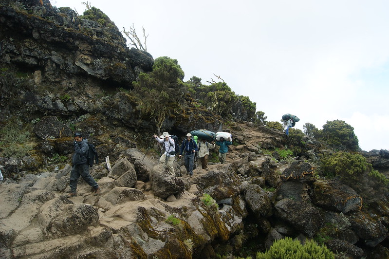
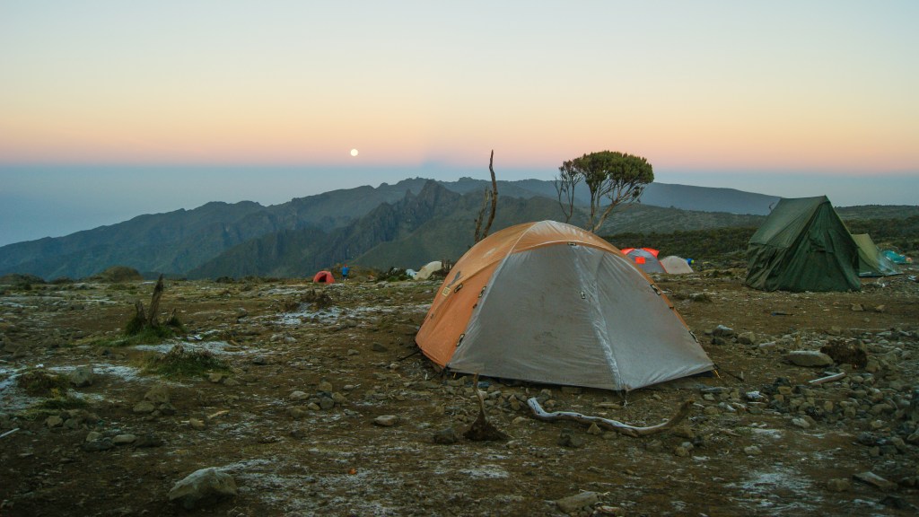
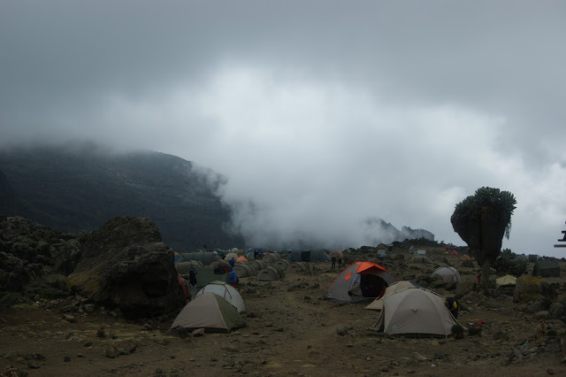
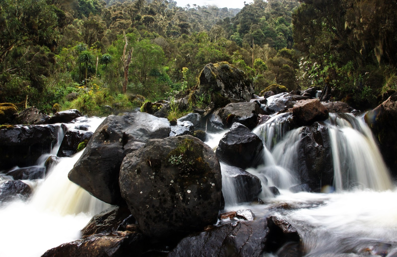
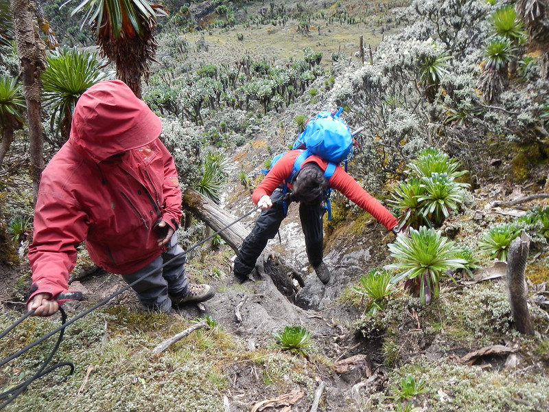
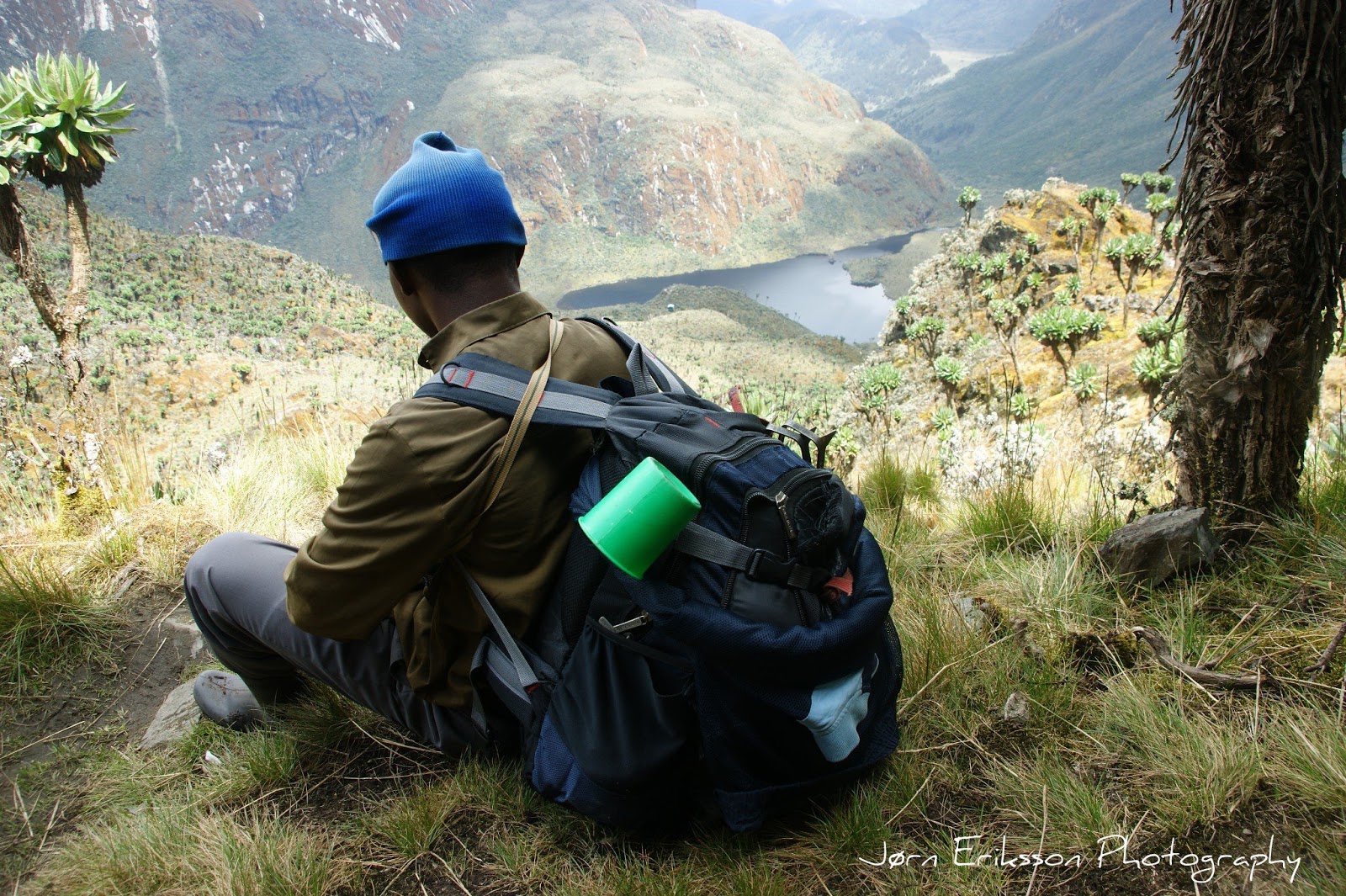
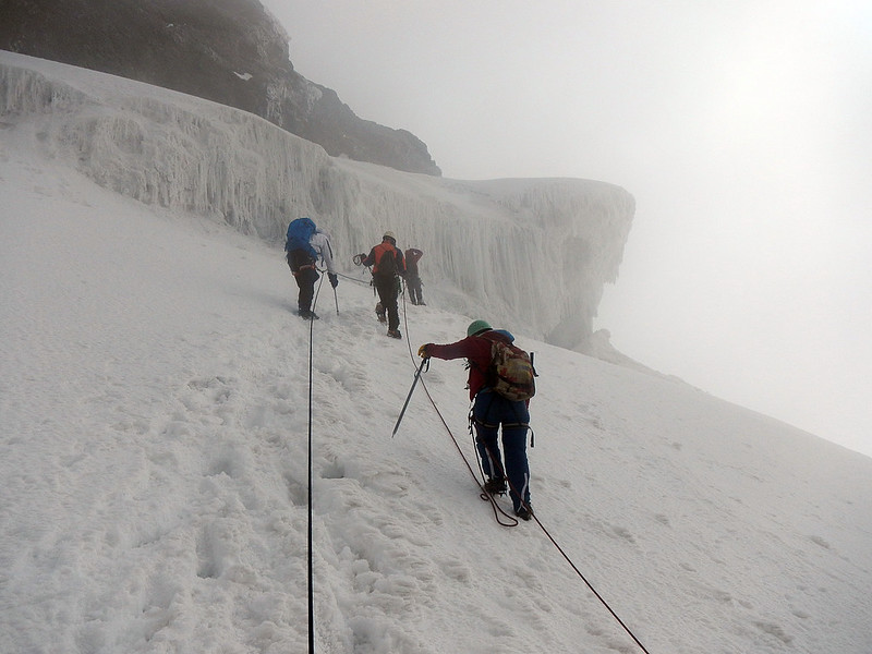
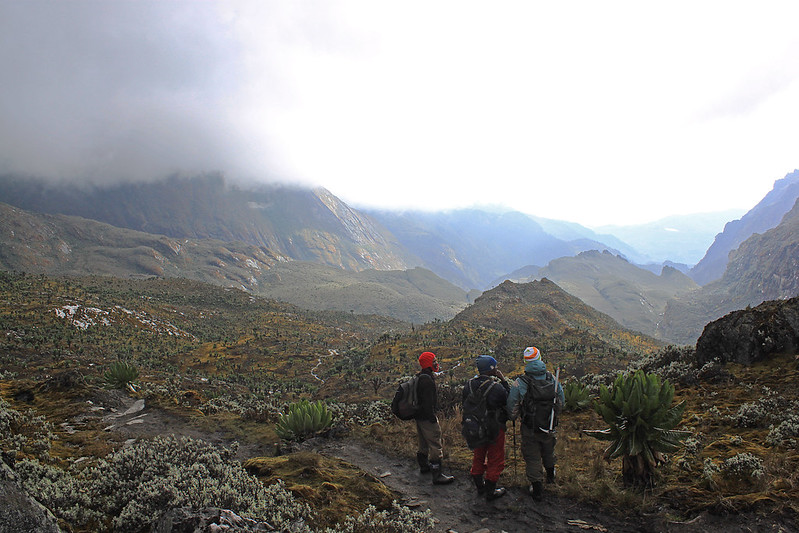
This day we walked through the classic terrain Rwenzori are known for, walking through the bogs, and especially the Lower Big Bog.  Our mountain boots were packed down, and on our feet we had good old gum boots. I bought mine in the village, and the soles were so thin that it felt like walking barefoot. This no easy stage on the Rwenzori trek, and I almost broke my leg as it went between the boards on the board walk over parts of the bog. Lesson was learned. Attention had to be given at all times. After a few hours hike we arrived at Bujuku lake,  an extraordinary scenary. Still hiking here killed the excitment, as it was no walk in the park, but in deep mud. We arrived Bujuku huts early afternoon. This would be our starting point climbing Africa’s 4th highest mountain.

We are having a meal in Bujuku hut, thinking about the challenges in front of us.


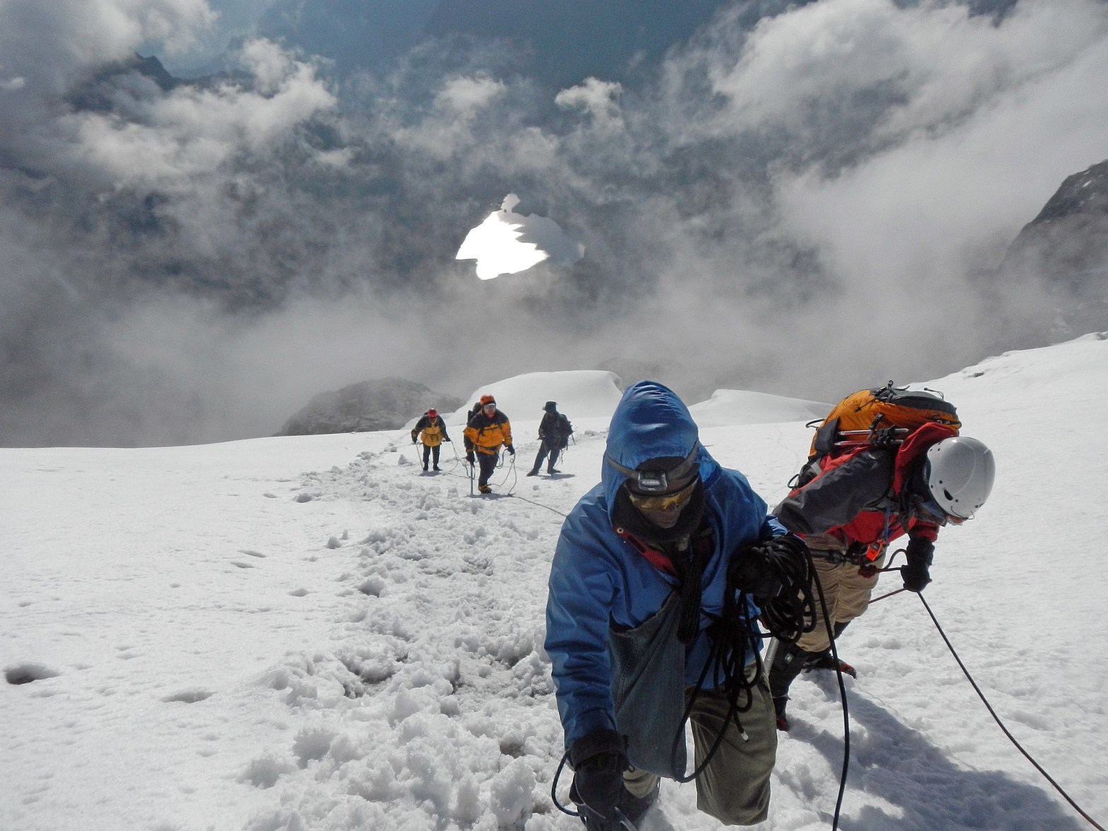
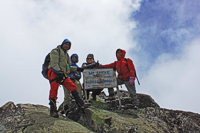
Day 7, Climbing Mount Speke (4890 masl.)

A happy lot on the summit Mt. Speke 4890 masl. I am in the middle.

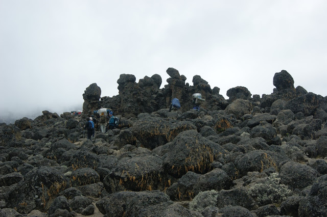
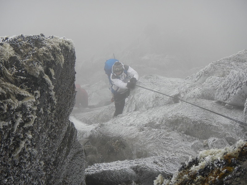
 It normally takes 3 days to hike up to Bujuku Huts that are base camp for this climb. From Bujuku you need a full day for the climb. There are two normal routes (2013) to the summit. One is considerable longer but involves only scrambling Grade 3. The most common route is a grade 4 route and a rope should be carried, and put to use if ice and snow. Crampons and ice axe are needed on this trip. However we didn’t use the crampons since the snow on the glacier was soft. It is recommended to use rope ascending and descending the crux of the route any way. In difference from Mt. Stanley there are no fixed ropes on Speke. We spent 5 hours climbing up including pauses, but I am not certain how long time we spent going down. It was just not a concern of mine. My guess is 3 hours. At Bujuku the elevation is 3960 masl. at the summit it’s 4890. That ment that we had to climb 930 altitude metres up to almost 5000 masl. Obviously this would be a though day in this altitude. We started walking about 5 AM in complete darkness. First we ascended up to the Schulman pass following a good path. The slope was easy. At some point the path seperates, and we turned right, and the terrain started to get steeper. Not long after we reached the first of the two sections where a rope should be considered on this route. However it was dry conditons, so we easily climbed up without. It was very dark, so it felt way more exposed than it really was. At the top of this slope we had to climb around a hanging three and then traverse in easy but exposed terrain until the slope got very gentle.

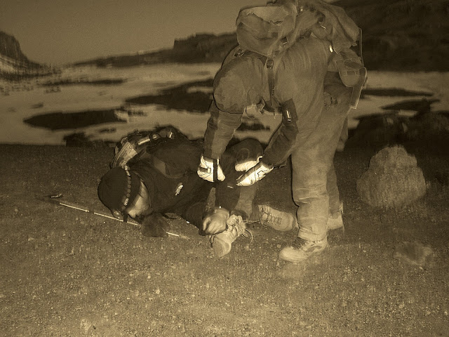
In the west one could now view a wonderful lake (Lake Speke) on the Congo side. However we couldn’t see it going up (We had clear and sunny weather going down) as a storm came over us. As we walked through some boulders heading for the crux of the route, a steep and icy upper section on the ridge we were now on, The wind was now so servere that we had serious doubts about continuing. We found shelter behind a huge rock and some discussion about what do to do. The most experienced guide put on crampons and the other guide went with him to secure him. The conditions were now extremely difficulty, and we watched with great concern. We didn’t bring helmets on this trip, but that is something one always should consider, as a big rock came falling down towards us. Luckely we all escaped it. I was told that rock fall was not very common on this route, or in Rwenzori, but one never know. Anyway, he managed to put up the rope, and a student guide (we had 3 locals with us) climbed up the rope without using a prusik. The result was scary. the student had problems on the icy rocks getting good grips and almost fell. I was properly secured to rope behind and came the student to rescue. I used an ascender on the rope, and with this I had no problems climbing up.

Strong wind plastering the rocks with ice, made an easy scramble to a difficult climb

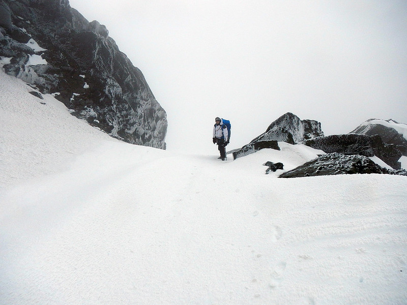
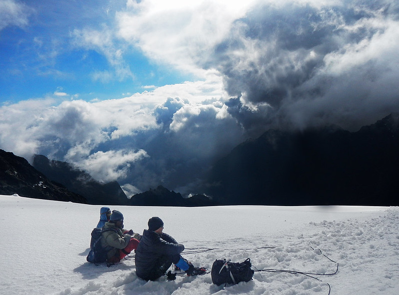
At the top of the rope, we stepped right and up an icy gully. We left the rope at the gully, and the rest of the climb was mostly a scramble with som exposed sections. It was still blowing strongly and we had little sight ahead. So our guide spent much time finding right way. At last we entered the snowfields on the upper glacier. The snow was soft, so we didn’t put on the crampons. As we came closer to the summit the weather also became better, and suddenly we got some brief moments where we could see Mt. Baker. Bujuku valley, Congo and Mt. Stanley. We continued our scramble going left, and before I even realised it we were at the summit.

Yep, this is in Africa!

There was good flat area a few metres below the summit that gave good shelter for the wind, and room for the five of us to have something to eat. Going down we abseiled the two steep sections described earlier.

I am enjoying this moment, as we had good weather going down,

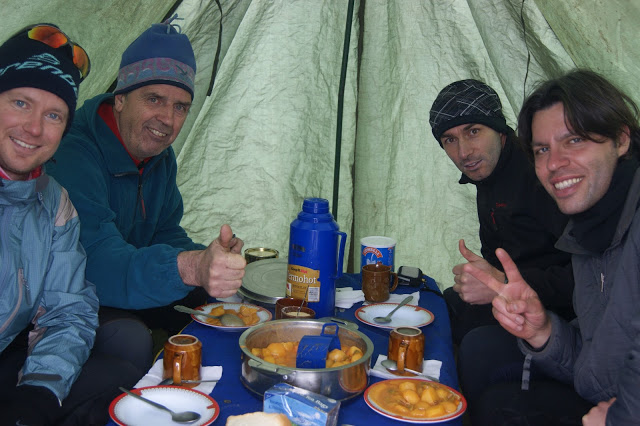
When we came back to Bujuku hut that afternoon we were not longer alone. Kenya Mountain Club had arrived with a group of five people. However they were not more than one Kenyan, as the others were Swedish, American, from New Zealand and Uganda. This group followed the same plan as us until after Margherita peak, staying in the same huts and rooms. This ment that we now had to make some new friends.


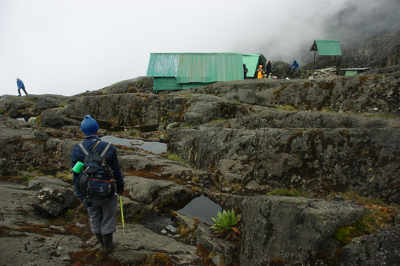
Day 8 Hiking to Elena Huts

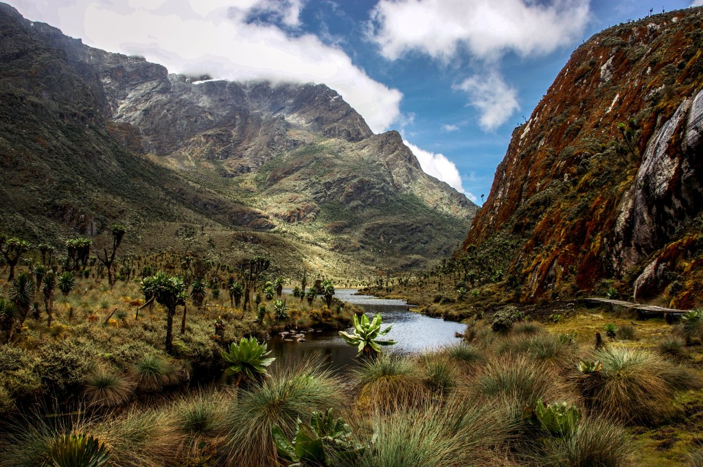
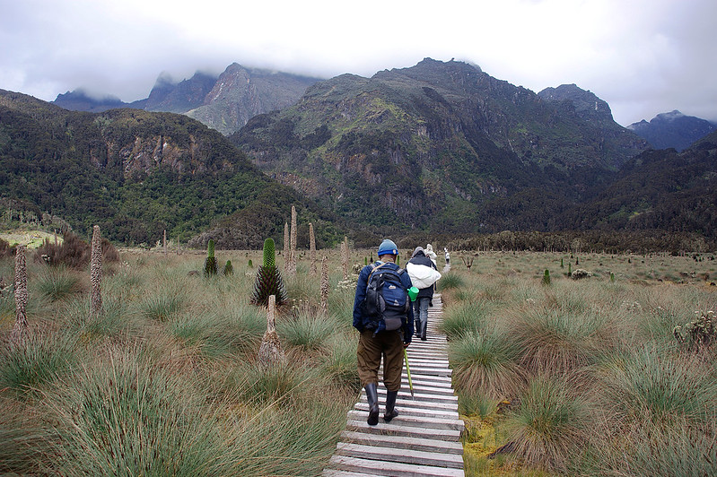
We slept long the next morning, as we only had a short leg going up to our basecamp for the climb of Africa’s third mountain, Margherita Peak on Stanley. Climbing a steep hill leads the way up to the Alpine zone of Mt. Stanley. Behind us is the wonderful Bujuku valley. There is no running water at Elena huts, only still water in a few  pits. This taste bad, but the porters drink it. We did too, but not without boiling it. The Elena huts it not a pleasurable place. The conditions are poor, and reminds you that the only reason you are here is to have a final rest before push for the summit.

Simple conditions meet us at the final camp before summit of Mt. Stanley.


Day 9 Climbing Marherita Peak, Mount Stanley (5109 masl.)

Mount Stanley, Africa’s third highest mountain.

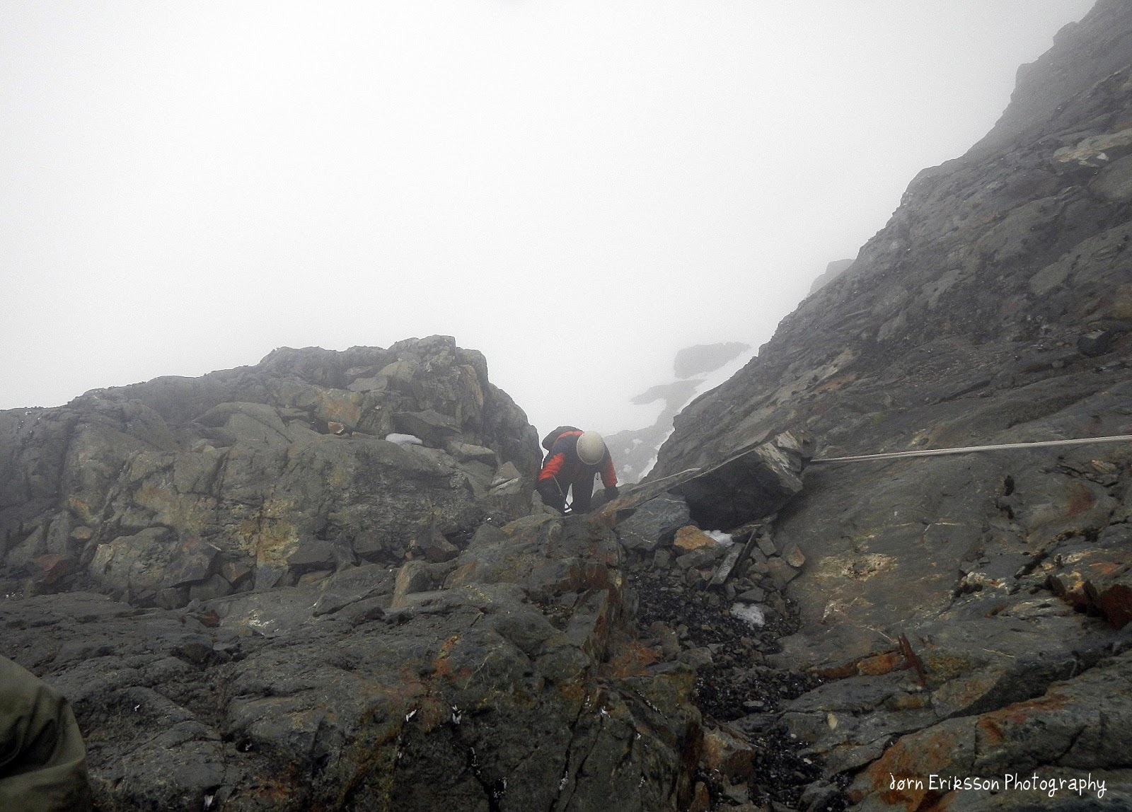
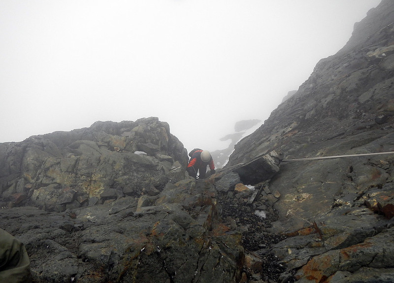
With an elevation of 5109 m it’s the highest mountain in both Congo and Uganda and the third highest mountain on the continent after Mount Kenya and Mt Kilimanjaro. The peaks are actually high enough to support a glacier and it was named after explorer Sir Henry Morton Stanley. It’s part of the UNESCO world heritage site that is Rwenzori Mountains National Park and was first summited in 1906 by Duke of the Abruzzi and his fellow climbers and was named Margherita Peak after the Queen Margherita of Italy.Mount Stanley is a mountain that should be taken serious, since there are no easy escapes down the mountain if altitude sickness or any injury. The help could be days away, and there are no medical support on the Mountain. We reached the summit in February 7th. As the glacier declines in high speed, most written route descriptions are not very useful as the guides has changed the route from Margerhita glacier and up to the peak. Even route descriptions being recently new is out of date. The only guidebook written on the topic does actually not describe this route since it was last updated in 2006. Earlier a ladder was used to get off the glacier, now it’s a new crux traversing a few metres on some narrow outcrops before ascending up a fixed rope that will bring you up on the North West Ridge. When you read this, things can likely be different.

Yofesi grew up in the rwenzori hills. He lives and works in Kampala, but still guides people to the summits of Rwenzori. We have had contact for many years after I visited.


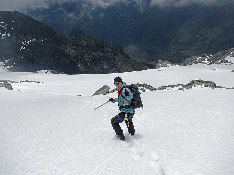
I found this climb less streneous than Mt. Speke. The climb starts at Elena huts on about 4500 masl.We started the climb in complete darkness, and it didn’t take long before we reached steep ground, and a fixed rope, leading to the Stanley Glacier. The glacier is a pleasent walk on a plateau, roping was not needed, and snow was not very deep. Now the sun was up, so we could actually enjoy walking. Still the mist didn’t give us much view. After a while we had to descend from the glacier around the foot of Alexandra peak, using another fixed rope (very good grips). From here we walked to the foot of the Margerhita Glacier where we put on crampons and roped up.

Clouds came and left during our ascent of this wonderful mountain


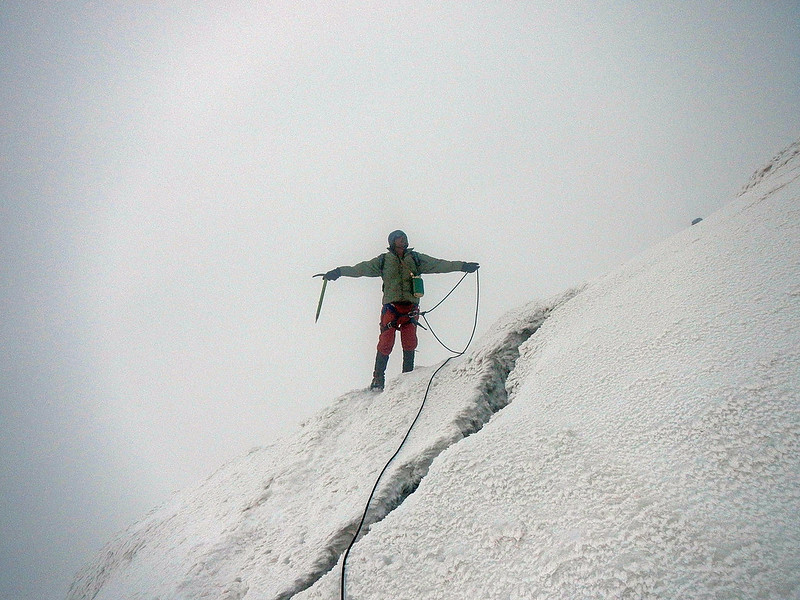
The Glacier is pretty steep. At one point I lost the camera on the snow, and had to throw my self after it like soccer goal keeper managing to save the precious photos before it descended to into the unknown. At this point the mist liftet and for about 10 minutes we had blue sky, sun and a clear view of the Bujuku valley and the two peaks Margerhita and Alexandra. It was a great scenary, and my best memory from the entire trek.

A moment in the sun. Me sitting nearest the camera man.

At the upper parts of the glacier we traversed left over a cravasse on to a narrow ledge of rocky outcrops leading to a steep gully with a fixed rope. This section is the crux of the climb and pretty airy, and when we descended the rain we got had made the icy rocks very slippery making it difficult to traverse the ledge. It’s a grade 5 YDS, but a very short section. This route is fairly new and has only been in use the last few years. As the ice melts one will need to find new routes also in the future. As we came up the fixed rope the party was still roped together as a fall would be fatal. We then left the rope and took off the crampons as the rest of the way to summit was only a scramble. However it started raining when we were at the summit making me regret that I didn’t bring the crampons up, because the water on the icy ground made the descend very unpleasent here.

this is just below the summit, and a few exposed metres of easy climb before one can walk the last metres and enjoy the reward.

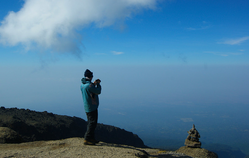
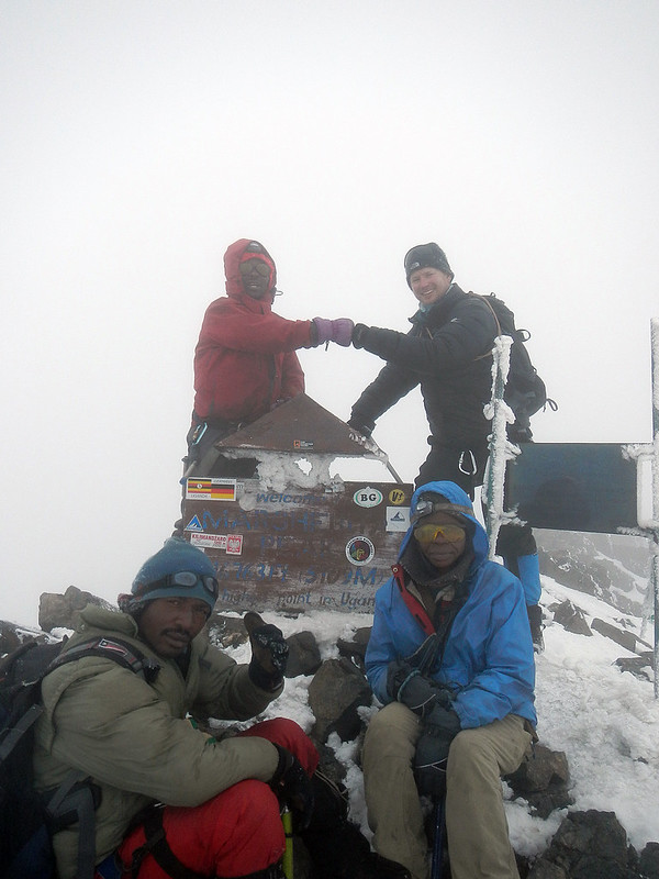
There was good room at the summit for photos, and we traversed the summit ridge further behind the big plate to a small cairn that shows the border between Uganda and Congo. This is a very exposed area so we had to be careful, and only two people could stand in Congo at the time as there was no more room, and steep drops on all sides.

Not room for everyone to take part in the photo on the summit. Andreas is the photographer. I continued walking beyond the summit point as I wanted to cross the border to Congo. The peak is actually partly in Congo.

We followed the same route back, having an half hour break at Elena Hut before trekking 4 hours down to the beautiful Kitandara lake.I injured my knee going up to Margerhita (early in the morning), and at this point the knee had swelled considerable, and I was not able to bend it. This made both me and our guides very concerned about the extremely long stage the next day back to Nyabitaba over Freshfield Pass (ca. 4200 masl). The scenary around Kitandara hut was breathtaking, and I guess I should celebrate that I now have added Africas 3rd and 4th highest mountain to my peak-list. However not being able to bend my knee made very concerned about the full day hike to Nyabitaba next morning.


Day 10 Over Fresh Field Pass 4282 masl. back down to Nyabitaba.

View from Fresh Field Pass

This would be hard day any way through some very difficult terrain where accidents are likely to happen.  It took me several pain killers and a lot of will to get back down. Andreas was frustrated and complainted about me walking to slowy. My knee looked like a ballon, so there was not much I could to do. Yet there was no other option. There is no easy rescue up there. Recently a climber died at Kitandara from altitude sickness. He practically  got trapped up there with no easy way down. We spent nearly 12 hours this day, and finally we got a taste of the rain these mountains are known for. When we reached the camp at night just as it got dark, I knew I had made it! The next day would be an easy return to the village. 

There is a time for everything. Now we could focus or intention the other beautiful wonders of the world


Day 11 Hike back to Nyakalenjiga and driving to Kampala

Our hard working team!

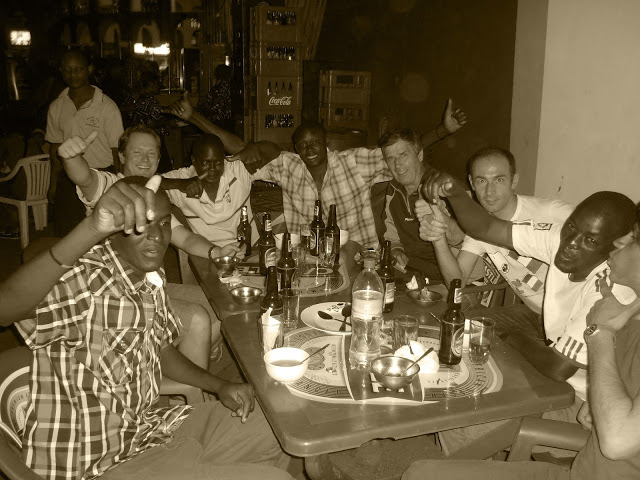
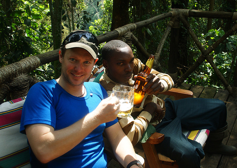
At Nyabitaba we had small cermony in the morning tipping the guides and porters. Andreas, the guides and I had an argument around the tipping, which is typical down here. It was not about how much to give, but the split between the crew. At the end everyone was happy, but it turned out that the porters was most happy with the beers we bought them at a lodge near the village. I have heard two years later that they still talk about this in the Rwenzori, as they had never experienced this from their clients before. It was ceirtanly a cheerful moment that I will remember for the rest of my life.

Back on the trekking station our driver had been waiting for several hours, and he was now anxious about driving us to Entebbe before it got dark. Once again we had a long drive (8 hours) full of wonderful impressions. However he realised that we would make it to Entebbe before dark, so instead we ended up in a hotel in central Kampala. The hotel was nice, but the bar a bit slow, so we wanted to head out on the town. We were advised to not leave the hotel after 8 PM, but that was an advise we were happy to ignore. We had a great evening, celebrating in one of Kampalas many bars, meeting great people. The fact that the door man carried a machine gun was a smaller detail we choosed to ignore at this point.

Time to jump back in the car. A long 8 hour drive waits


Day 12. Exploring Kampala, and flying out of Uganda.

The following day we had plenty of time to walk around Kampala. It’ was sunday but busy as any day could be. The traffic was a joke, and the streets full of people. I was glad to experience it, but happy to escape it too. In the afternoon we were on our way to the airport, and on our way to Doha. I couldn’t help my self feeling a bit sad leaving this rising country behind for this time.

Back in 2013 I made an amateur film from the expedition. It has supringsly more than 23K views. You can see it here:

You can see all photos from Rwenzori here (the gallery is not updated. I will do it as soon as possible.)

I have also planned to make a new and more proffesional film out of the footage from this trip during the autumn 2020.

Notes on climbing Kilimanjaro

The year was 2012, and for some reason I decided to go all alone to Tanzania and climb Kilimanjaro. I was not part of a group and organised my own trip. There is no reason why you should pay extra to a travel company in your company for this hike, since the local law says only local companies can operate on the mountain. You should therefore organise your trip directly with one of the companies in Moshi that have lisence to operate on the mountain, and then buy your flight ticket your self. The company will pick you up at the airport and fasilitate everything from there.

Thousands of people climb Kilimanjaro everyday, and hundreds push for the summit every night. They all have the aim, reaching the summit in time to see the sun rise over Africa for the highest point on the continent. Since I visitied Kilimanjaro I have climbed several other African mountains, and I have to say that Kilimanjaro was the easiest one. There is only one question for you if you otherwise is in good health: Can you handle the altitude? I did, and it was the start of many hard altitude trips later. However others didn’t. Who makes it, and who doesn’t is difficult to say. I walked with a very good marathon runner, that said “Tomorow I will reach the summit in only two hours.” Well he reached the summit, but at that point I was already back down from the summit, sleeping in my tent, and I have never been running much. We started walking at the same time.

So Climbing Kilimanjaro is a dream for many people. It’s achiveable for most people, but it’s certainly no walk in the park. As many as 60% that tries never reach the summit. It’s actually the more difficult routes that have highest success rate, while the “easy” Coca-Cola route has the highest failure.

I went alone from Norway to Kilimanjaro to climb the scenic “Whiskey-Route” from Machame Gate. At the hotel my 1-man expedition joined 4 Italians also climbing the same route. We were accompanied by 12 porters, chef and guide and assistant guide. Here are my notes and reflections from the trek.

Stage 1: Machame Gate to Machame Huts:
Distance 12 km. Altimeter 1800 – 2900. Duration 5 hours

The few first steps on the Kilimanarjo-adventure

My race for the summit didn’t start at Machame gate, but already in Oslo. I spent 35 hours getting to my destination as airports in Europe closed because of snow. A cancelled flight to Amsterdam, a sick pilot in London, and the fact that my flight in London also almost got cancelled, and finally that KLM messed up my flights so I got stuck for hours in Dar Es Saalam without a ticket to Kilimanjaro, made me doubt that I would ever get to Machame Gate, and at least not the summit. But somehow made it there, with a few new grey hairs on my head.

Anyways back to the start of the hike. Driving with an old buss from the hotel in Moshi would normally take about an hour, but numerous errands by the guides made the trip an hour longer. It didn’t concern me as enjoyed the time studying the lively and seemingly chaotic African roadside. 

A blue monkey hangs around the gate to see if there is food to grab

When arriving at the gate, we had to register before we could start our walk. While standing in line for registration street vendors tried eagerly to sell  hats, t-shirts and drinks, and the porters were busy organising who was going to carry what. It was a busy place, and a reminder that tihis all business. After 1-2 hours waiting at the gate we could finally start our six days long hike to Africa’s highest point, Uhuru Peak. It felt good! I knew I would enjoy every single step of the trip, hard or not.

The lunch box I got on the first day

The first day  is a more than 10 km long walk through the rainforest. I love rain forests. The first 3 km is an easy walk along a 4WD road while the rest goes along a path that cut’s through the the deep and thick rainforest. The threes gives good protection from the strong sun, and the temperature in the forest was much more pleasant than the 33 degrees we had in Moshi earlier. We were lucky with the weather also, as we escaped rain. I enjoyed walking in the forest very much. I spotted blue monkeys, and I could hear the monkey-like screams from the Turaco, and I spent the time chatting and getting to know my guides, while the carriers rushed by us. As we gained altitude the threes got smaller and from clearings we could enjoy great views over the forests.

Already as we started our walk the guides stressed the importance of walking “pole pole” – slowly, slowly. So I spent all the time I could on the walk, taking photos and enjoying the beauty of the forest. I had to rush, knowing we had all day on a relatively short walk.

Machame camp. Our first camp.

In the afternoon we arrived at 3100 metres altitude the Machame camp. Again we had to register, before we could jump into our yellow / orange tents that the porters already had put up.
Now we were introduced for a few rituals that would remain the same every day. First washing, then tea, and not much later dinner.  The rest of the afternoon I spent talking with other hikers, and the crew. There was also the stressing issue of going to the horrible toiltet facility, something one would not get used to on this trip. I tried to get some reception on my phone, but that ship had already sailed.
At around ten I crawled down in my sleeping bag, and already this first night the temperature crawled below zero. There were many people at camp, and a buzzing noise of voices and singing only stopped for a couple of hours that night. The rescue this night, and every night after was my mp3 player.  A very good memory from this trip was a wonderful view over the land below with a low hanging moon shining on Kilimanjaro.

Stage 2: Machame Huts to Shira Caves
Distance 7 km. Altitude gained 820m. Duration 5 hours

A scene from stage 2

After spending the night at the Machame Huts, we were waken around 6:30 next morning. After a long and good breakfast with sausages and eggs we started the 5 km climb to the Shira caves. This was the easiest stage on the six days long trek. However the terrain is a little steep and now we could feel the altitude making it harder. Still “Pole Pole” was the golden rule, and on this stage you have a lot of time on your hands. The terrain was now very different from the previous day. The shadows of the Rainforest was gone, and the boiling sun was hammering on our necks. I used the strongest sun lotion I could find. Still Imanaged to get burned this day.

With the lower vegetation we were now rewarded with great views in all directions. above us was Kilimanjaro, and below us was the great forests. For the first time we could also spot Mount Meru in the horisont.  A line of porters and trekkers pointet the route to the Shira plateau. At lunch stop the big white-necked ravens appared in numbers, and from this point these scavengers were always present on our hike.

The White Necked Ravens are a common sight on the mountain, also described in a Hemingway short story from the slopes of Kilimanjaro.

As the day went on we could see all the way down to Machame Gate, and the camp we left in the morning. Interesting and exotic vegetation appeared and it was an interesting walk to Shira caves camp. 

We arrived the Shira camp very early, and this camp is where we spent most time. This ment that there was plenty time for socialising with other trekkers and porters, and we also made a little walk to the caves that gives name to the camp. On some rocks a short walk from camp it was also possible to make phone calls, so this place was very bussy at all times. We were now at 3840 metres altitude, and from now on I always had what we called the “the one percent headache.” 

Shira camp, that I liked very much for it’s scenary

The Shira camp is a beautiful one, and the afternoon views as the sun set were of the type I hoped to experience when I went on this trip. The Shira plateau is also your best hope when it comes to spotting larger animals. Buffaloes and other animals have been seen here, but we didn’t see anything larger than mice and the many white-necked ravens. 

The night at Shira was very cold. For the first time my Helsport Isfjorden winter sleeping bag came to my full use. 

Stage 3: Shira Caves to Barranco
Distance 13 km. Altitude gained: 150 metres.Duration 7 hours

This was an exciting day for us, as we took an acclimatitation trip to Lava Tower at respectable 4623 metres altitude, before going down to Barranco at “only” 3900 metres. At the end of the day we had only won a few metres altitude from our efforts. However going high, and sleeping low is the key for this route’s high success rate compared with other routes on the mountain. 

At this day we moved from the western part of the Kilimanjaro to the Southern side via LavaTower.The walking terrain was easy and not very steep, but perhaps somewhat monotonous.  After a few hours when arriving at the foot of Lava Tower, the porters had set up our dining tent, and tea and a big warm lunch waited (I am really impressed with the standars and the service provided by our porters).

At Lava Tower there is also an encampment for those choosing the less popularWestern Breach route. This route is steeper and exposed for rock falls. At Lava Tower Kilimanjaro is now hanging over our heads. However now we started descenting down the beautiful Barranco valley alongside a stream coming down the mountain. Now we got introduced to the very special threes “Senecio Johnstonii.”  Still most of us had trouble enjoying the scenaries since we all suffered from head aches coming down from Lava Tower. 

When I arrived camp that afternoon  the little  headache I had disappered, and wold not be a noticable again before my descent from Uhuru Peak. This campsite was also very scenic, but at this point I for the first time on the hike felt a bit exhausted and spent all the time not eating, in my sleeping bag. It was also very cold this night with temperature as low as minus 15 degrees celsius.

Stage 4: Barranco camp – Barrafu
Distance 13 km. Altimeter 3950 m- 4666 m. Duration 7 hours

The 4th day was a long one. Not only because this is where we skipped the 7th day, choosing to not sleep over at Karanga camp, but instead going  the full length to Barafu Camp. But also because the same evening we would start our push for the summit, Uhuru Peak. 

The day started early. We were waken six in the morning, after the coldest night so far. -15 degrees celsius. After breakfast the most technical part on the whole trek waited us, climbing up Barranco wall. The 300 metres high wall looked steep and for some frightening  at start, but as you start climbing you will find good grips all the way. The first half hour is a bit strenous, and trekking poles had to be put away as we needed both hands scrambling up the wall. But remember, the porters easily carries heavy loads on their heads up here too, and the terrain never gets much exposed. When finally arriving at the top of the wall and hour later, we were rewarded with a massive view.

After this we continued downhill down a valley before we once again had to go up the somewhat steep terrain to Karanga. At Karanga we had a longer and very good lunch, before walking 3 more hours up to our last camp before summit, the rocky  Barafu. 

Barafu is a hectic place in a dusty moon landscape

This was a beautiful place, and the weather was good too. However at 4668 metres altitude I could now really feel that the air was thinner. Still I felt very good, no headache or other things. I was simply very fit for the last stretch to summit. 

The Barafu toilet is really on the egde. Lonely Planet used this photo in a book about toilets around the world, and the photo went viral after that, and being sold numerous times. Funny that a photo of a toilet should be the the one I got known for;-)

Stage 5: Barafu – Uhuru Peak – Mweka camp
Distance 22 km. Altimeter 4668 – 5895 – 3100. Duration 11-12 hours

This was it! The big moment had come. It was time to push for  the summit. I went to my tent a little before eight o’clock in the evening. Knowing that I now only had 3,5 hours to sleep, and that a long and streneous night waited I found it hard to sleep at all. To much was at stake, everything else than reaching Uhuru Peak would be a big failure. Let’s face it. Exuses like “The journey, not the destination is most important”  has no value at this point. On Kili the summit is everything.

Our staff let us sleep until midnight, but the buzz from those starting earlier made it impossible to sleep. So I decided to wake up a little earlier so I could pack my bag, prepare my headlamp and clothes, get my water boiled, and go to the toilet  etc. without breaking the golden rule “Pole Pole (slowly slowly).”

It was blowing strong and cold winds,  so we knew this would be an extremely cold night even though the temperature was not more than minus 6-7 degrees celsius. Adding the wind it must have been -20.  I put on 2 layers of wool, 1 fleece, 1 Bergans duvet jacket, 1 windbreaker, balaklava and even a beanie, still I was cold going up. However, no one was going very fast, and some people were hardly moving at all.

A special phenomena, as what appear to be an mountain at the right, is actually the shadow of Kilimanjaro. Mt. Meru another high African mountain is seen to the left.

It had been a long day, but still I felt more than ready for the long night walk. After being served a warm cup of tea (we didn’t get any food before starting) and a long wait for the 4 litres of water I wanted for my trip to the summit we were finally ready. However we were now one of the last ones to start walking. A string of light showed the trail upwards. I didn’t imagine before going that it would be so many people. In fact you will manage fine without a headlamp, because when hundreds of lamps light up it’s like one giant one. The walk up is very monotone walking in line up the steep path. I held a phase that was very slowly, but I had few breaks. As we walked up some people were escorted down because of altitude sickness. Every 1,5 hour I ate a tube of energy gel. I had boiled water on my camelback, and by blowing back after every sip I managed to avoid the it to freeze before Stella Point.

Altitude sickness is a big problem on kilimanjaro with many inexperienced climbers pushing for the summit. This Italian man didn’t make it to the summit, but was helped down to Barafu camp, and recovered enought there to walk down the mountain on own feet.

While focus going up was on putting one foot in front of the other, I realised early on the walk that this would not be a problem, it would be hard but not a problem. It was great feeling giving me extra energy, and I enjoyed  the lights from the towns below. It  was just the way you see it from an airplane flying at night. Imagine seeing this not sitting behind a small cabinvindow. It was something to remember.  A woman going in front of my had problems keeping her balance. Many times I was ready to take her fall if she fell backwards. After a while she couldn’t go on. If she went back down or continued after a break I don’t know. But when I reached Stella Point together with our of the assistant guide, there was suddenly only a couple of people in front off us. Now we could also see the first lights from people coming up the Marangu-route. Marko, the assistant asked me where the others in our group were. I pointed to the summit. – No, my friend. They are down there. He pointet down, but I couldn’t even see them. I was suprised that our slowly but steady tempo had parked more or less everyone trekking from Barafu this night. Everyday I had lived by the mantra “Pole Pole” coming in among the last ones on every stage. Now we were among the very firs to the summit, and I that without a headache. However the last but not difficult stretch from Stella Point to Uhuru Peak felt very long.

Sunrise seen from the roof top of Africa

When we arrived at Uhuru Peak it was still dark, so we had to wait for sunrise. No problem, as a  large group of noisy Americans already were there we now had take part in a battle for a place in front of the the large Sign on the summit. Everyone wanted their photo taken – alone- there, and some people became a bit desperate keeping others away starting yelling at others. I guess their climax of reaching the summit was a bit more than they could handle. In the end we got our photo, and before heading back down I got to see the sunrise over Africa from Uhuru Peak. This was our goal, and standing here now proved that everything had gone as planned. The impressive sight of Kilimanjaro’s shadow, an impressive mirage of the mountain is especially worth mentioning. The beautiful colored glaciers too, and for those who have the time and energy, the crater rim.

Returning back down, herds of people were now coming up. I met my Italian friends at Stella Point. Four of them made it to Uhuru Peak while one was suffering so bad from altitude sickness that he had no choice but returning. He didn’t recover completely before were came back to Moshi. Altitude sickness is absolutly a terrible thing to get, and as I forgot all about how high we were and started running down from Stella Point I got a reminder as a headache came sneaking up on me. I was exhausted when returning back to the camp at Barafu (4668 m), and I slept like rock for 2-3 hours. Coming down early gave me  well needed extra time to rest. 

An iconic beer enjoyed on the mountain it’s named after

The headache vanished as I drank two liters of water – That’s a lot better cure than pills. Around noon we got warm lunch before starting walking all the way down to 3100 metres. This was hard on our knees after a long day on horrible paths. Coming down two the rescue hut at around 4000 metres I managed to buy couple of  local Kilimanjaro Beers for me and Marko who assisted me to the summit. The celebration continued when we came down to Mweka camp at 3100 with  a couple of more beers. My legs were tired now, and I slept feeling that  my sleeping bag was like being in a hotel bed that night. 

Stage 6 Mweka Camp – Mweka Gate
Distance 10 km. Duration: 3 hours Altimeter 3100 – 1800 

Nothing to worry about anymore, just be happy. We made it!

This was the  last and most boring stage, even as we walked through some beautiful rainforest. After sleeping like a rock after the summiting the previous day, I felt well rested when the porters woke us up in the morning. After another great breakfast, we started the last “transportation stage” down to the Mweka village.  Most of the way we walked on a well maintained path or road . We were promised to see some colubus monkies, but we were not that lucky. Still we were  happy after a successful trip for most of us, and thinking about a warm shower, swimming pool and cold beers didn’t make us less happier.

Porters celebrating at the Mweka camp night at summit climb. In general there was a lot of singing on this trek. There were few silent moments. 

When coming down to Mweka, we once again had to register with the park authorities. A large crowd of vendors sell everything from t-shirts, paintings to beers. Like most climbers I ended up buing one of thosetacky tourist t-shirts saying “Just Done it – Kilimanjaro.”
After our climb we received a certificate with our name and time of arrival at the summit to prove our achivements, a nice souvenir I felt.

After the climb we were all driven to a hotel called Kilimanjaro Crane Hotel. It was a central lying hotel with a friendly staff.I spent the afternoon lying at the pool, before I met up with my Italian climbing mates, our guides and porters in the evening. Together we celebrated into the night, and it was great experience to take part in the Moshi nightlife.

An merorable night with new friends in Moshi. I went to Tanzania alone, but was never lonely.

The next day my guide and a few of his staff came to the hotel to pick me up. He wanted to show me his village and invite me for lunch in his house. It was an enjoyable time, and  I got to met his lovely wife and children.

In the afternoon I had still a couple of hours left before my ride to the airport. So I went for shopping in Moshi town, but after a only half an hour I had enough as a tail of curious Africans followed me everywhere, and all the way back to the hotel. Still I managed to buy some typcial souvenirs to bring with me home. Early evening a buss from Zara Tours came and picked me up at the hotel. The drive to the airport was nervewrecking – You can’t believe how the Tanzanians drive. They actually have a huge problems with traffic killings. However what I will remember the most from the drive back to the airport was seeing in Mount Meru in sunset. Maybe I will go there one day?